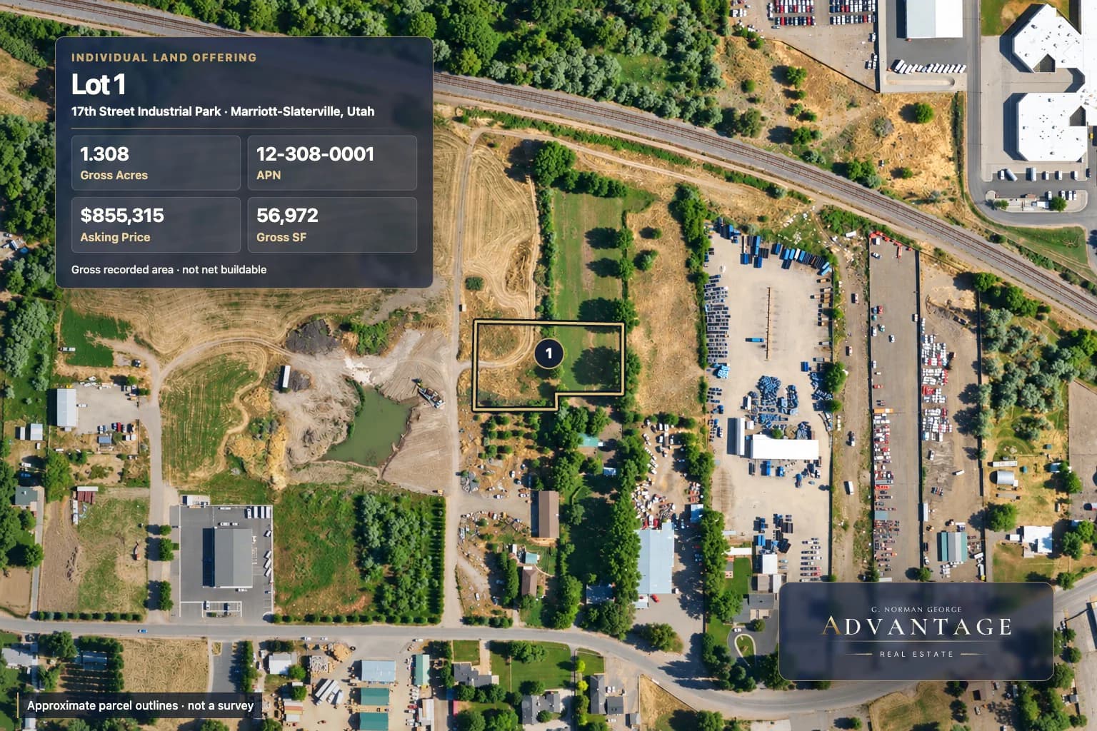
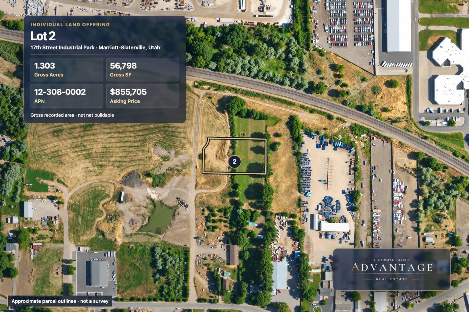
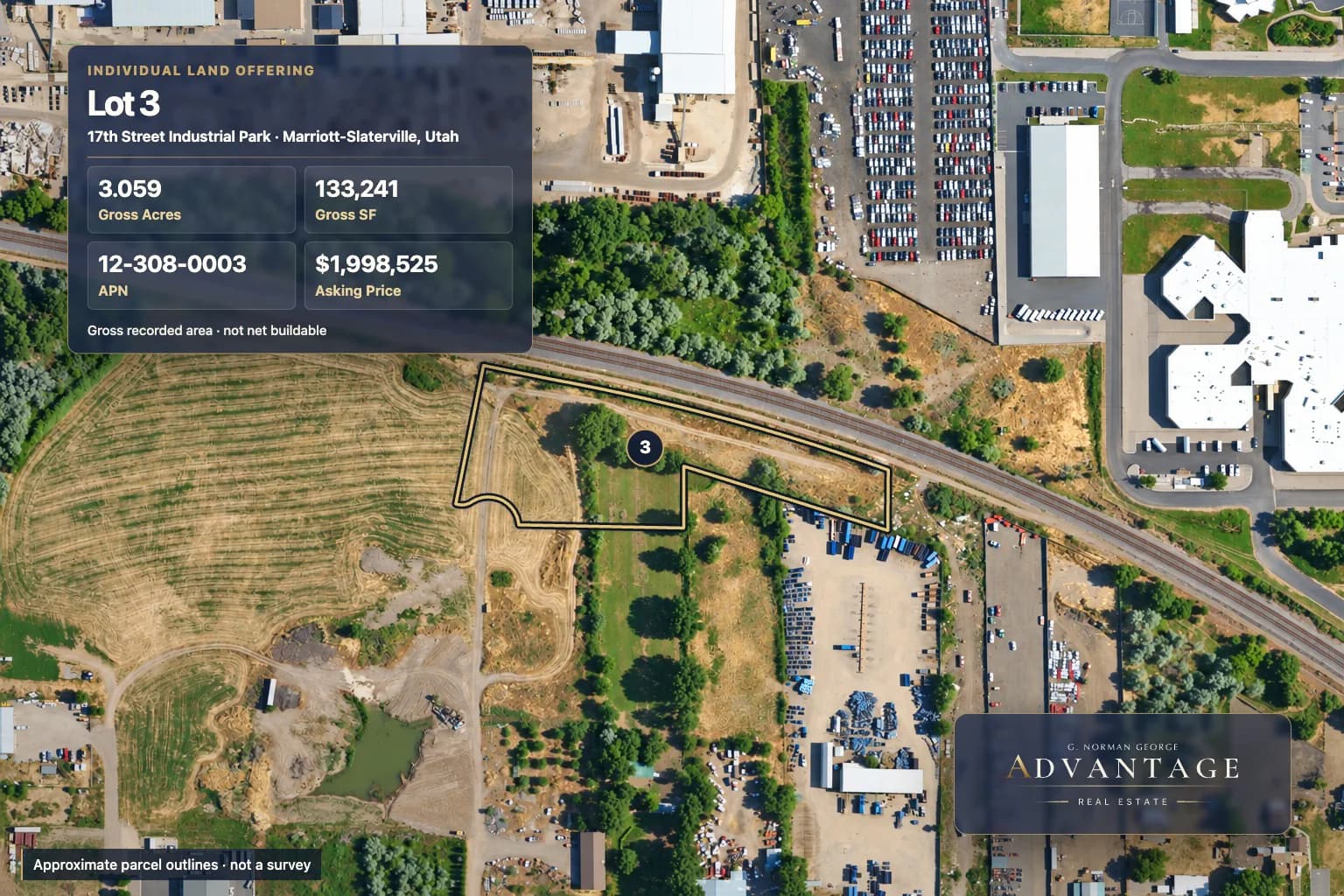
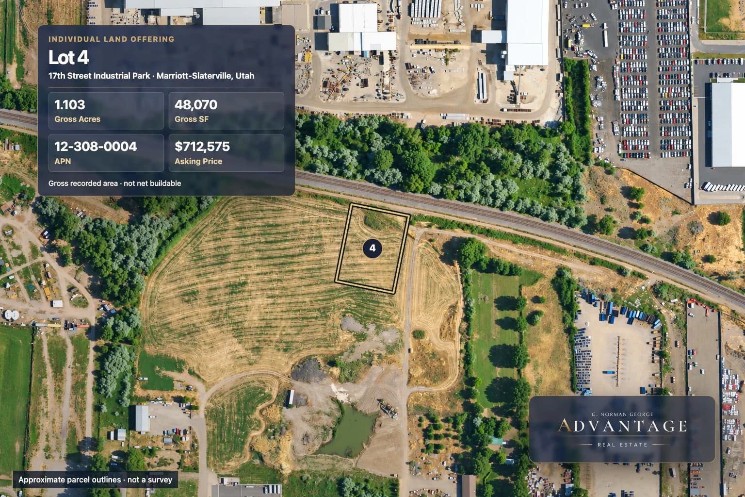
- Gas easement
- The recorded plat depicts an existing 20-foot gas easement crossing the lot.
- Irrigation easement
- A 15-foot irrigation easement is depicted along the east side and part of the south boundary.
- Utility easement
- A 10-foot public utility easement is depicted along street frontage.
Area is the gross lot area printed on the recorded plat and is not a net-buildable-area statement. Confirm current zoning, permitted uses, utility service/capacity, and development requirements. The recorded plat depicts an existing 20-foot gas easement across this lot, referenced to the Combe 17th Street Subdivision Plat; verify its recorded terms, location, and effect before planning improvements. It does not establish gas service.